
FLASH FLOOD WARNING ISSUED RIVERSIDE COUNTY
FLASH FLOOD WARNING ISSUED
Photos: Conditions at 415p and 743p via Radar!
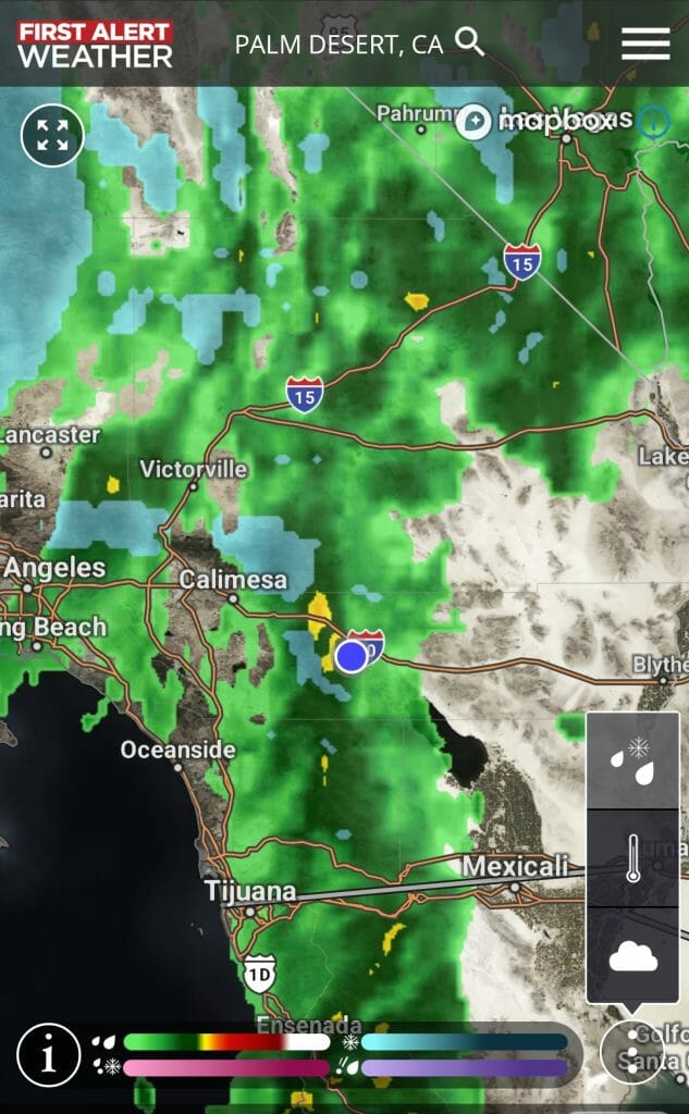
Photo: Conditions at 415p via Radar!
Flood Warning: Take Action! A Flood Warning is issued when the hazardous weather event is imminent or already happening. A Flood Warning is issued when flooding is imminent or occurring.
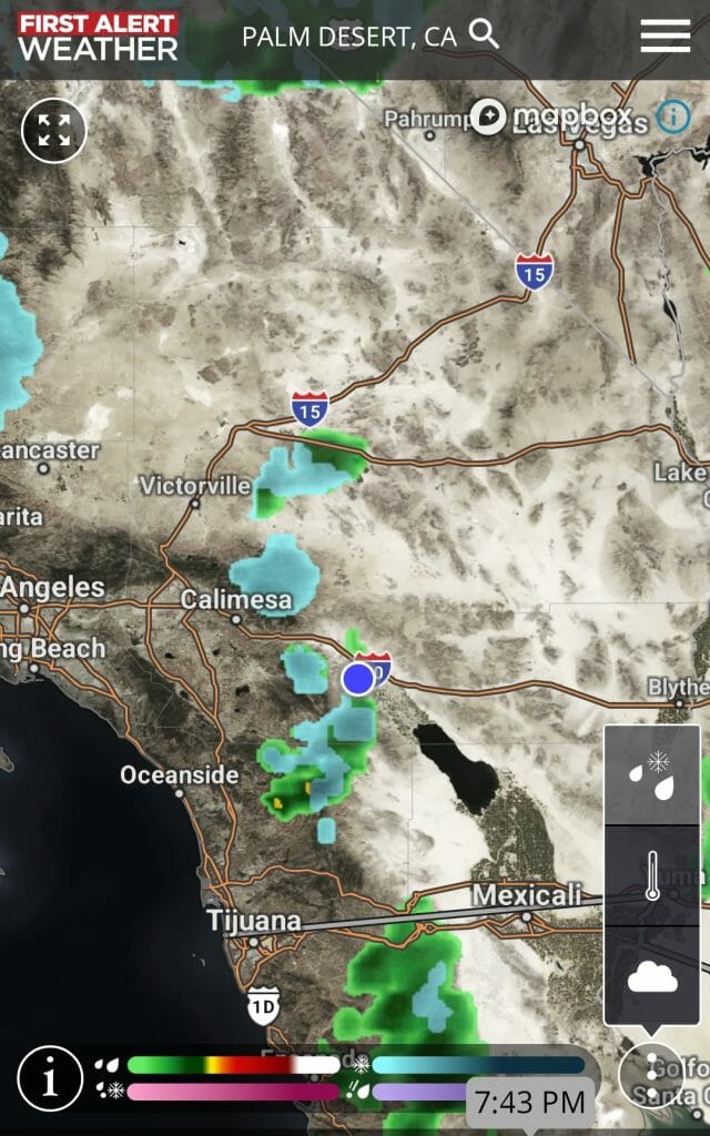
Photo: Conditions at 743p via Radar!
Detailed forecast for the Coachella Valley
Tuesday:
WIND ADVISORY NOW IN EFFECT FROM 4 AM TUESDAY TO MIDNIGHT PST
- WHAT…Southwest winds 20 to 30 mph with gusts 35 to 45 mph
expected. - WHERE…Coachella Valley, San Gorgonio Pass Near Banning,
Orange County Coastal Areas, Santa Ana Mountains and Foothills
and San Diego County Coastal Areas. - WHEN…From 4 AM Tuesday to midnight PST Tuesday night.
- IMPACTS…Gusty winds could blow around unsecured objects.
Tree limbs could be blown down and a few power outages may
result. - ADDITIONAL DETAILS…Winds will be strongest along the immediate
coast, over ridges in the Santa Ana Mountains and through the
I-10 corridor into the Coachella Valley.
PRECAUTIONARY/PREPAREDNESS ACTIONS…
Use extra caution when driving, especially if operating a high profile vehicle. Secure outdoor objects.
| Flood Advisory | |
| Alert: | …FLOOD ADVISORY IN EFFECT UNTIL 4 PM PST THIS AFTERNOON… * WHAT…Flooding caused by excessive rainfall is expected. * WHERE…A portion of Southern California, including the following counties, Riverside and San Bernardino. * WHEN…Until 400 PM PST. * IMPACTS…Minor flooding in low-lying and poor drainage areas. Rises in small streams and normally dry arroyos. * ADDITIONAL DETAILS… – At 100 PM PST, Doppler radar and automated rain gauges indicated moderate to heavy rain. Minor flooding is ongoing or expected to begin shortly in and near the Apple and El Dorado burn scars. – Some locations that will experience flooding include… Yucaipa, Forest Falls, southern Mount San Gorgonio, Beaumont, Banning, Hwy 38 Between Yucaipa And Onyx Summit, Mountain Home Village, Calimesa, Cherry Valley and Morongo Indian Reservation. |
Tuesday Night:
Partly cloudy with showers likely and slight chance of thunderstorms in the evening, then mostly clear overnight. Lows 36 to 41. Areas of winds north 15 to 25 mph with gusts to 35 mph. Chance of measurable precipitation 70 percent.
Related Articles
Coachella Valley Flooding – Are you prepared?
Coachella Valley Flooding – Are you prepared? Flooding is the most common natural disaster and can occur anywhere. Flooding can

High Wind Warning until 10:00PM Saturday
Alert * WHAT…West winds 25 to 35 mph with gusts to 60 mph expected. * WHERE…San Bernardino County Mountains, Riverside County Mountains, San
Coachella Valley Alert – Wind Advisory – 60 mph Gusts
Start: Sunday, 4/4, 11:00 PM PDTEnd: Tuesday, 4/6, 5:00 AM PDTSource: U.S. National Weather Service …WIND ADVISORY REMAINS IN EFFECT UNTIL 5 AM PDT
