
Rabbit Fire burns 7,600 acres of brush evacuation orders in place

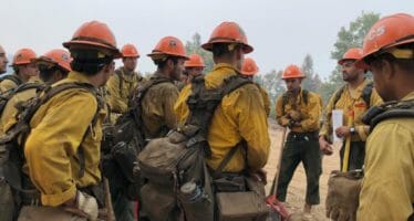
CAL FIRE/Riverside County Firefighters are on scene of a vegetation fire burning near the intersection of Alessandro Blvd and Jack Rabbit Trail, in the community of Lakeview. The fire was initially reported as 20 acres and burning with a rapid rate of spread. The fire is currently mapped at 7600 acres and 5% contained. A road closure is in place on Gilman Springs from Alessandro Blvd to Highway 79 and Bridge Street from Gilman Springs Rd to Ramona Expy. More information will be posted as it becomes available.
Situation Summary
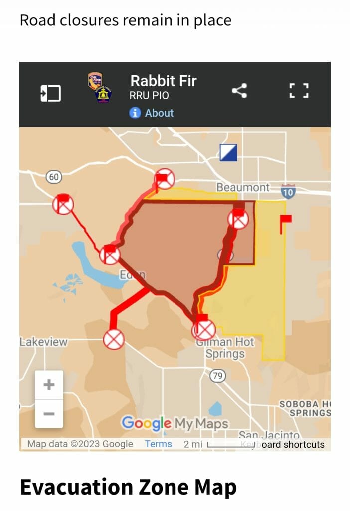
Road closures remain in place
Evacuation Zone Map
Find your way to safety from the Rabbit Fire in Riverside counties.
INCIDENT INFORMATION
Resources Assigned
Firefighters: 315
Helicopters: 4
Engine Companies: 40
Air Tankers: 5
Overhead Personnel: 15
Fire Crews: 12
Air Attack: Yes
EMD: Yes
Law Enforcement: Yes
Ambulance Ground: 0
Ambulance Air: 0
Truck Companies: 0
Water Tenders: 10
RVC Medic: 0
Utilities: No
American Red Cross: No
Fire Investigator: Yes
Public Information Officer: Yes
Displaced Persons: No
Specialized Equipment:
Cooperating Agencies
BDU/CAL FIRE, CAL FIRE/Riverside, Soboba Fire Department
Incident Name: Rabbit
Incident Address: Near the Intersection of Alessandro Blvd and Jack Rabbit Trail, in Lakeview (East of Moreno Valley)
Community: Lakeview
Loss: 0
Saved: 0
Cause: Under Investigation
Incident Type: Vegetation Fire
Incident Number: CA-RRU-102458
Date/Time Reported: 7/14/2023 3:26:00 PM
Est. Containment Date/Time:
Est. Control Date/Time:
Evacuations: Yes
Evacuation Comments:
07/15/23 UPDATE 4:00 PM: Evacuation Warning Area Expanded: North of East 1st Street East of Jack Rabbit Trail South of West 4th Street West of California Avenue
East of Manzanita Park Road West of Highland Springs Road South of East 1st Street North of Forest Boundary Line.
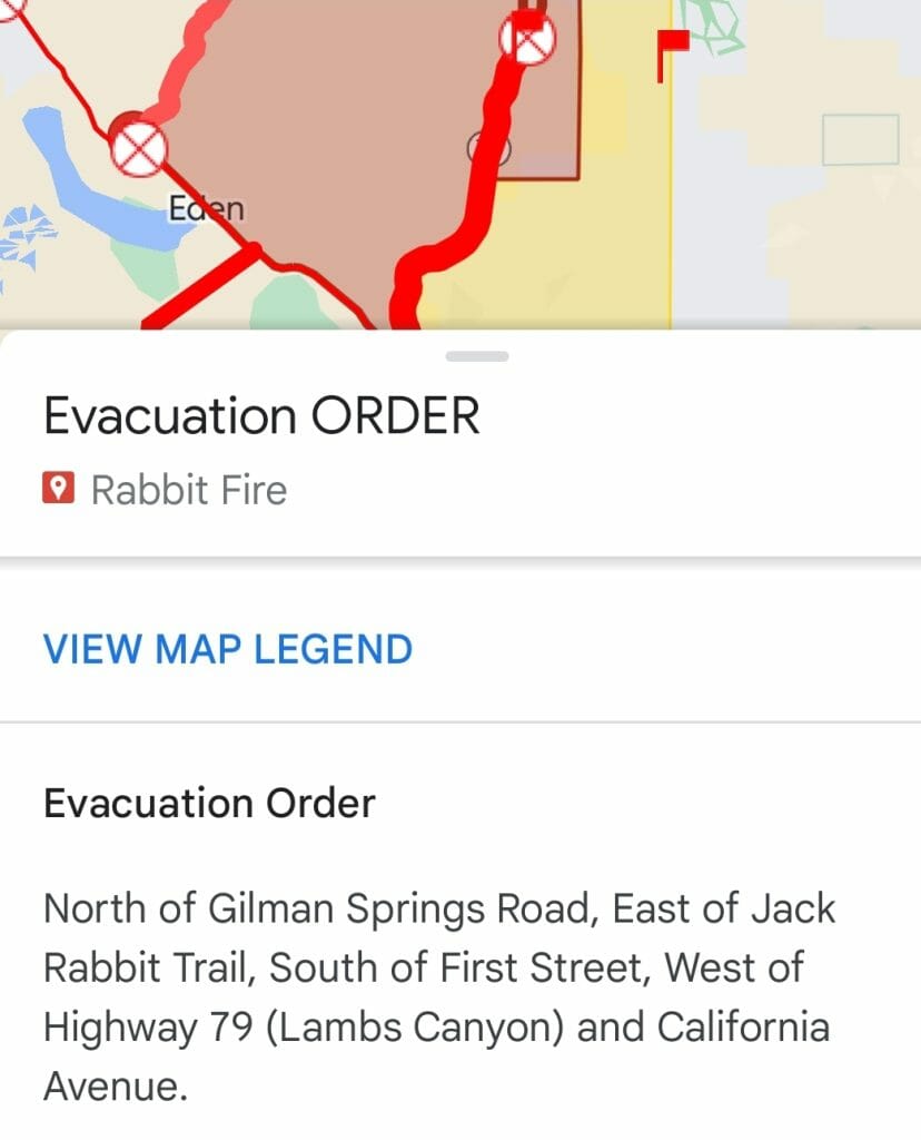
7/15/23 UPDATE 3:35 PM – Two previous Evacuation Warning Zones are now under an Evacuation Order.
North and West of Highway 79 (Lambs Canyon), East of California Avenue and South of First Street.
North of County Landfill (Lamb Canyon Road), East of Highway 79 (Lambs Canyon), South of E. First Street and West of Manzanita Park Road.
Follow this link to search if you are in an affected area: http://linktr.ee/calfirerru
Related Articles
Cranston Fire Update, Arson, 89% contained, 13,139 acres burned, 889 Personel
Cranston Fire #CranstonFire #Update 12:00p August 1st. 89% contained, 13,139 acres burned, 889 Personel #CranstonFire #Update 12:00p July 30th About 560 people in Mountain

25th anniversary Jazz in the Pines survives Cranston Fire, let the “Music” play on……….
MUSIC Jazz in the Pines will go on as scheduled! Let the music play on!!! Idyllwild Arts was
Cranston Fire Update, Arson, 100% containment expected by August 9th, 170 Personel still on hand, current containment 96%
Cranston Fire Update, Arson, 96% contained, 13,139 acres burned, 170 Personel on hand. 100% Containment is expected by August 9, 2018. All evacuations have been
