
Winter Storm Warning issued April 5 at 3:28AM PDT til April 9 at 5:00AM PDT
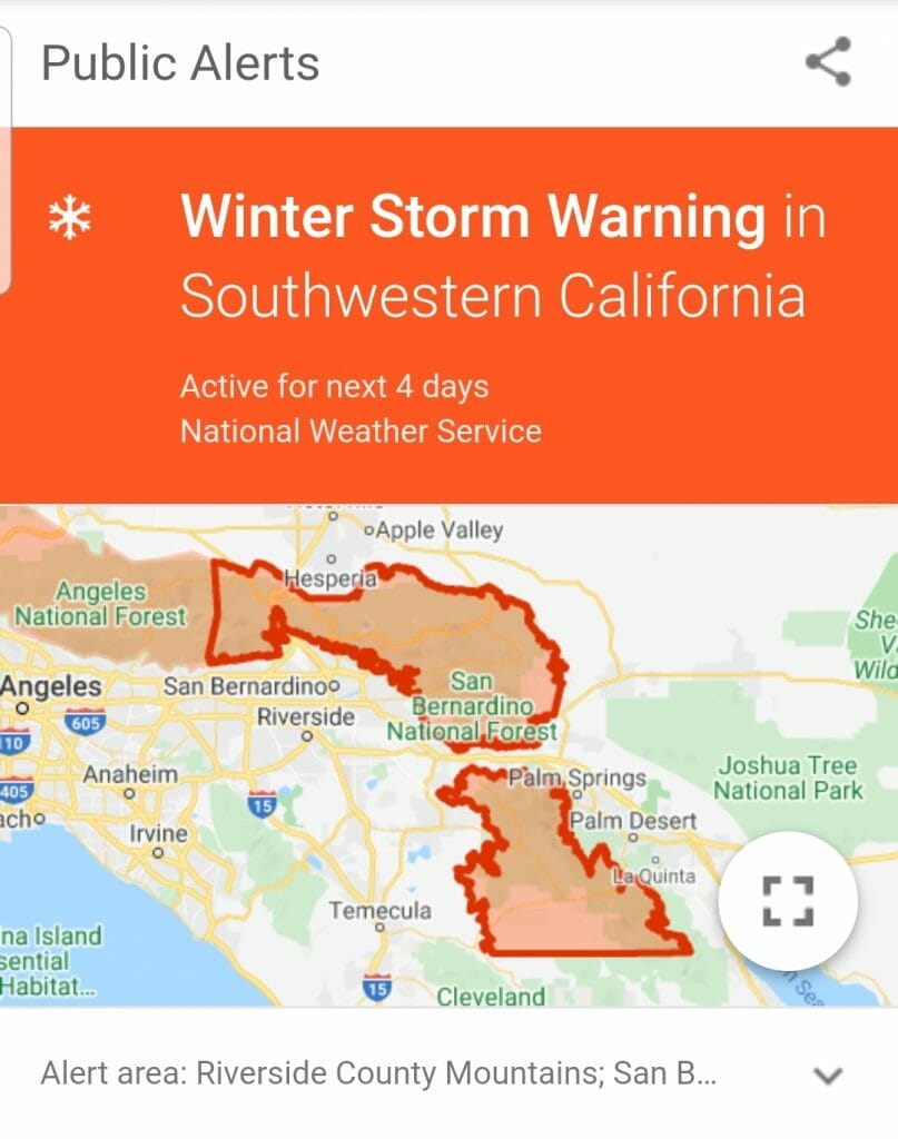
WINTER STORM WARNING IN EFFECT FROM 11 PM THIS EVENING TO 5 AM
PDT THURSDAY ABOVE 5500 FEET…
* WHAT…Heavy snow expected. Travel will be very difficult to impossible, including during the morning commute on Monday. Tree branches could fall as well.
Total snow accumulations will be 4 to 12 inches between 5000 to 6000 feet, 1 to 2 feet between 6000 to 7000 feet, and 2 to 4 feet above 7000 feet.
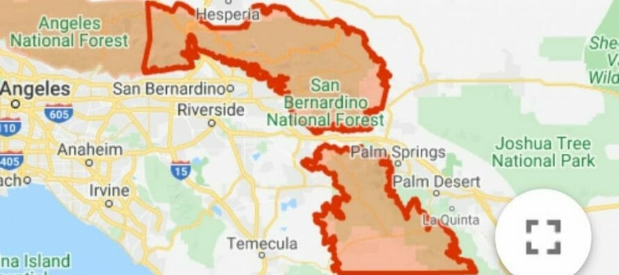
* WHERE…Mountains of San Bernardino and Riverside Counties, above 5500 feet. The heaviest snow will occur above 6500 feet.
* WHEN…11 PM this evening to 5 AM Thursday morning.
* ADDITIONAL DETAILS…Be prepared for significant reductions in visibility at times.
PRECAUTIONARY/PREPAREDNESS ACTIONS…
A Winter Storm Warning for snow means severe winter weather conditions are expected.
If you must travel, keep an extra
flashlight, food and water in your vehicle in case of anemergency.
For road condition information in California…enter
8 0 0 4 2 7 7 6 2 3 if inside california or
9 1 6 4 5 5 7 6 2 3 if outside California.
Related Articles

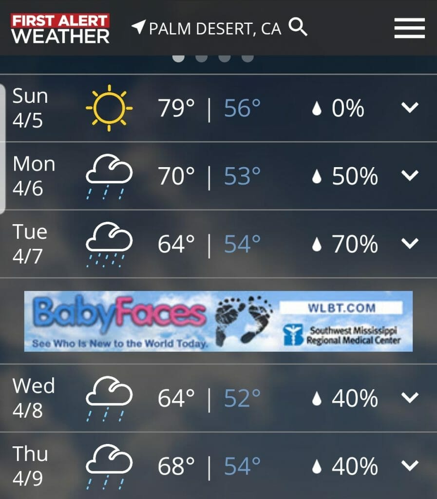
Warm up, Santa Ana Winds Expected In Coachella Valley and a chance of showers possible by mid-week.
#cvwx #palmsprings Cover by Dean Mayo, Joshua Tree National Park Story written by California News Wire Services RIVERSIDE COUNTY, CA —

Coachella Valley Weather Forecast – Record High Temperatures Expected #cvwx
August 18th – Except for a few afternoon clouds, mainly sunny. Record high temperatures expected. Day High 116F – breezy 5-10mph.
