
Winter Storm Warning issued April 5 at 3:28AM PDT til April 9 at 5:00AM PDT
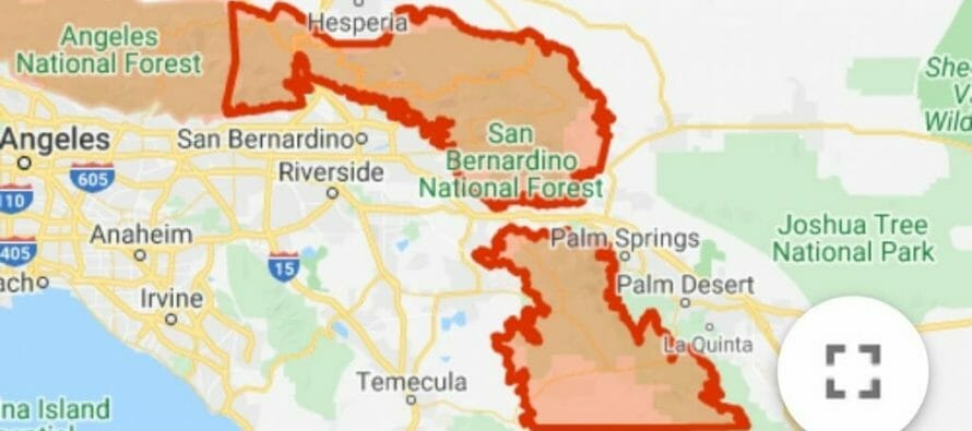
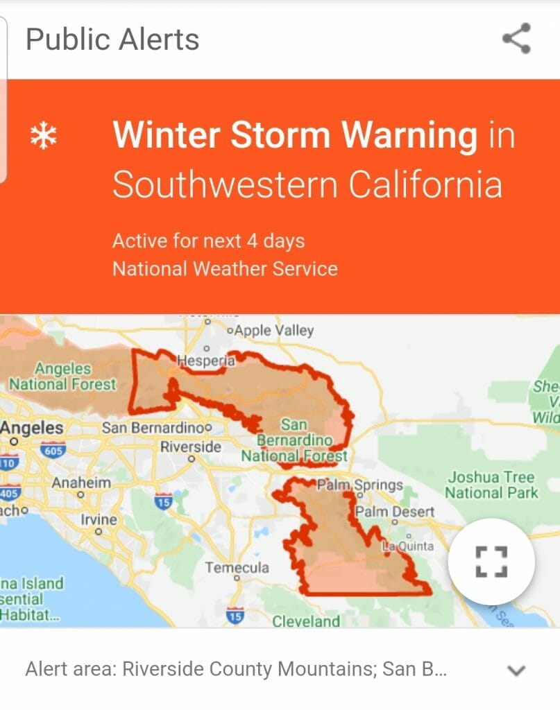
WINTER STORM WARNING IN EFFECT FROM 11 PM THIS EVENING TO 5 AM
PDT THURSDAY ABOVE 5500 FEET…
* WHAT…Heavy snow expected. Travel will be very difficult to impossible, including during the morning commute on Monday. Tree branches could fall as well.
Total snow accumulations will be 4 to 12 inches between 5000 to 6000 feet, 1 to 2 feet between 6000 to 7000 feet, and 2 to 4 feet above 7000 feet.
* WHERE…Mountains of San Bernardino and Riverside Counties, above 5500 feet. The heaviest snow will occur above 6500 feet.
* WHEN…11 PM this evening to 5 AM Thursday morning.
* ADDITIONAL DETAILS…Be prepared for significant reductions in visibility at times.
PRECAUTIONARY/PREPAREDNESS ACTIONS…
A Winter Storm Warning for snow means severe winter weather conditions are expected.
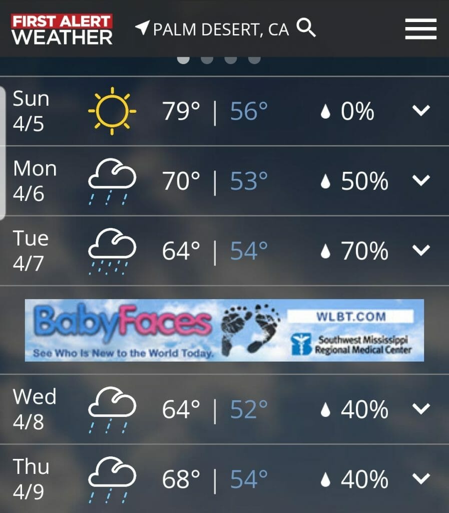
If you must travel, keep an extra
flashlight, food and water in your vehicle in case of anemergency.
For road condition information in California…enter
8 0 0 4 2 7 7 6 2 3 if inside california or
9 1 6 4 5 5 7 6 2 3 if outside California.
Related Articles

Alert: Excessive Heat Warning until 8PM Monday
* WHAT…Dangerously hot conditions with temperatures around 117 expected. * WHERE…Coachella Valley, San Diego County Deserts and San Gorgonio Pass Near

Climate Scientists See Evidence Drought Will End Next Winter
“The Blob” notwithstanding its silly name, this meteorological phenomenon could herald the impending end of California’s devestating drought, according
Excessive Heat Warning in effect from 10 am Tuesday to 9 pm pdt Friday
Excessive Heat Warning UPDATED MAY 4, 1:20 PM Valid Until 9:00pm, Fri, May 8 Excessive heat warning in effect from 10 am tuesday to 9
